Geography of Mesopotamia
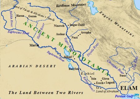
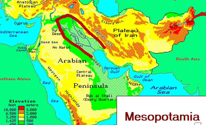
The word 'Mesopotamia' is in origin a Greek name (mesos 'middle' and potamos 'river', so 'land between the rivers'). The name is used for the area between by the Euphrates and Tigris and its tributaries, roughly comprising modern Iraq and parts of Syria. South of modern Bagdad, the alluvial plains of the rivers were called the land of Sumer . Sumer is the most southern part where the Euphrates and Tigris are close to each other. In the second millennium both region is called Babylonia, a mostly flat country.